Investing in PierSight
Building the Future of Global-Scale Earth Monitoring

“All civilizations become either spacefaring or extinct” - Carl Sagan, astronomer and science communicator
Humanity's fascination with the cosmos has been an enduring aspect of our history and sparked the development of instruments aiding our exploration and understanding of the universe. In 1957, the Soviets launched the first vehicle carrying a satellite into deep space. This historic event ushered in a period marked by the Space Race, a brief yet impactful period of geopolitical rivalry in the conquest of space. It spurred substantial investments from various entities, including governments and private organizations. Today, we find ourselves in the era often referred to as 'NewSpace' or 'Space 3.0,' characterized by the democratization of space access where private enterprises work independently of governments to further push the limits of space technology and exploration.
SAR can penetrate cloud cover and forest canopies, and it doesn't rely on sunlight, making it practical for imaging the Earth's surface in all weather conditions and at all times of day or night.
Just as the ancient civilizations gazed at celestial bodies for wisdom, we now have the privilege of peering back at Earth from the vast expanse of space, harnessing technology to unravel the mysteries of our planet. This pursuit of Earth observation from satellites enables us to harness the immense potential of our home world – from understanding the weather patterns and mineral reserves to providing aerial views of our streets through platforms like Google Maps.
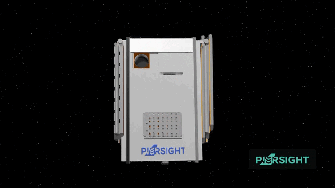
There are currently ~1,200 satellites observing the Earth closely and a majority of them are optical, relying on sunlight to illuminate the Earth's surface and capture images. This approach has limitations, particularly in areas not facing the Sun and regions covered by dense forest canopies, which make up 70% of the Earth at any given point in time. To overcome this constraint, a specific class of satellites has pioneered a different approach by emitting a beam of microwave radiation toward Earth and capturing the reflected signals — akin to the echo-location abilities of a bat. These satellites fall under the classification of SAR or 'Synthetic Aperture Radar’. SAR technology is still emerging, with companies like Capella and ICEYE initiating early constellations. SAR can penetrate cloud cover and forest canopies, and it doesn't rely on sunlight, making it practical for imaging the Earth's surface in all weather conditions and at all times of day or night.
PierSight identified a significant opportunity in maritime surveillance.
However, these SAR satellites consume substantial power to transmit signals from space to Earth and back, resulting in the current generation of SAR imagery being exceedingly expensive on a per-square-foot basis and constrained by operational limitations, with satellites effectively operational for around 12 minutes per recharge cycle. As a result, the market average price for SAR is $1.6 per square kilometer and a typical shot costs a minimum of $500.
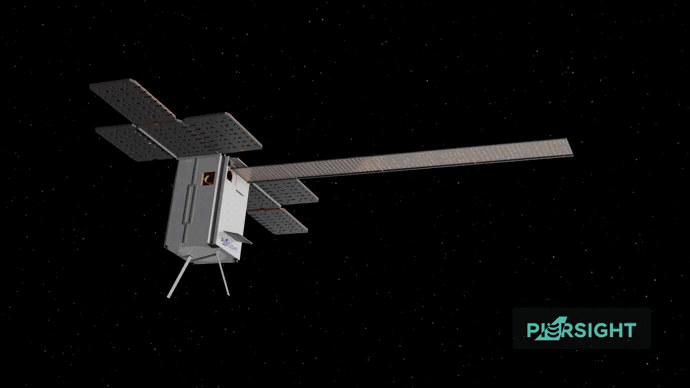
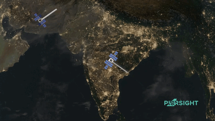
That’s why we are thrilled to announce our partnership with Gaurav and Vinit from PierSight, who are aiming to solve this problem uniquely through a network of application-specific Synthetic Aperture Radar (SAR) Imaging and Automatic Identification System (AIS) satellites for ocean imaging. While existing players focus on enhancing refresh rates by adding multiple SAR satellites to their constellations, PierSight identified a significant opportunity in maritime surveillance.
PierSight’s first constellation aims to offer unmatched maritime domain awareness at 1/6th the cost of existing solutions.
Covering over 70% of the Earth’s surface, the world’s oceans serve as the lifeblood of our global economy, facilitating crucial trade routes and offering access to abundant resources like minerals, oil, and fish. However, due to their vast expanse and limited accessibility, oceans have remained relatively under-monitored, presenting significant challenges. This lack of comprehensive surveillance has amplified threats, with oceans serving as clandestine pathways for terrorist activities — underscored by tragic events like the 2008 Mumbai terror attack — and hotbeds for piracy.
SAR satellites require less power to scan over ships and icebergs compared to land-based assets due to their high reflectivity. Leveraging this trade-off, the team has constructed a design that can capture large swathes of area and provide high image refresh cycles of 30 minutes – enabling near-persistent monitoring of the oceans. PierSight’s first constellation aims to offer unmatched maritime domain awareness at 1/6th the cost of existing solutions.
This presents unprecedented opportunities for governments and defense organizations worldwide, offering enhanced capabilities to vigilantly monitor their Exclusive Economic Zones (EEZs). Illegal fishing alone causes economic losses of up to $50 billion annually, while oil spills are difficult to monitor and combat. The demand for SAR from governments is ever-growing, with both established space agencies like NASA and sovereign countries like Ukraine even signing pre-launch contracts in space. The current utilization of SAR satellites is near 100% in high-impact regions, with governments having to wait in queue to seek the required image. Companies like ICEYE and Capella have been able to generate blanket purchase agreements from agencies like NASA, the National Reconnaissance Office, and the European Union.
Moreover, it empowers private ship liners by providing crucial data for route planning, particularly in navigating hazardous iceberg-laden Transatlantic regions. Beyond navigation, SAR has also found use cases in commercial scope, with the insurance industry being the earliest adopter. By utilizing SAR imagery, insurance companies can more accurately underwrite premiums for capital assets like ships and containers by better assessing risks and improving claims management, as SAR allows for detailed observation of the asset's condition both before and after any incidents.

Gaurav is a seasoned space professional who brings eight years of experience from working on SAR projects with ISRO as a scientist, while Vinit hails from National Instruments, where he contributed to mission-critical projects with DRDO and ISRO. In our interactions with Gaurav and Vinit, the PierSight team exhibited impressive dedication and a proactive approach. Collaborating closely with DRDO, they showcased a commitment to refining their technology through iterative testing before final satellite development. Witnessing their technical prowess and strategic design choices, it became evident why they are highly regarded within the circles of ISRO. PierSight aims to launch its first set of satellites within the next 18 months and plans to establish a fully operational constellation by 2027. We are thrilled to be part of this audacious journey from their formative days, revolutionizing how the world observes the ocean — one satellite at a time.
We couldn’t be more excited to co-lead PierSight’s $6 mn Seed round and work with Gaurav and Vinit on their vision to transform ocean monitoring and the maritime industry. They are currently hiring.
Related
 Investing in Atlys21 . 09 . 2023
- Investing in Bluelearn03 . 04 . 2023
- Investing in Solar Square16 . 02 . 2023
- Investing in Rigi25 . 01 . 2023


Elevation Founder Pulse 2023
What it means to be an entrepreneur in 2023